One
Light Year
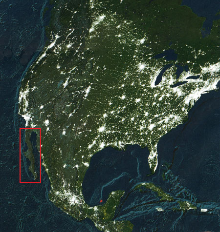
This is a map of light sources, compiled
from satellite images taken on cloud-free nights over a
one year period. It's an interesting display of concentrations
of voters, wealth, and industrialization. As you can see,
with the exception of Tijuana, Ensenada, La Paz, Los Cabos
and Mexicali, the peninsula is as dark as a the inside of
a Black Forest cake. But if you squint a little, you can
see an enemic glow where San Felipe is spreading her condos.
A small red smear here and there indicates
places where there is a natural gas burnoff. Given the amount
of refired beans eaten here in town, you'd thing San Felipe's
aura would burn bright indeed.
Yellow areas indicate fires burning.
|